Zoe Meier · 19 October 2026
Analyzing Environmental Balances During Pinora's Regional Development Phases
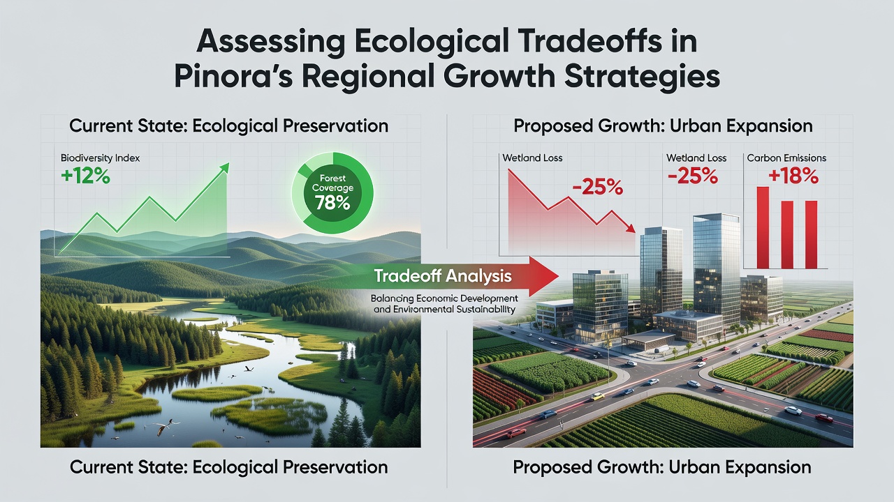
Pinora's regional growth strategies have expanded across multiple zones since early planning phases, and observers note that ecological assessments now form a core component of these efforts. Data from ongoing monitoring programs reveal shifts in land cover, water usage patterns, and habitat connectivity as infrastructure and research facilities come online, while independent evaluations track both gains in economic activity and corresponding pressures on local ecosystems.
Core Elements of Pinora's Expansion Framework
Regional planners working with Pinora have outlined several development corridors that integrate university partnerships and data-driven supply chain projects, and these corridors intersect with sensitive environmental zones in documented ways. Reports compiled through 2025 highlight how construction timelines align with seasonal migration cycles for certain species, whereas site selection processes incorporate soil stability metrics and watershed boundaries to reduce runoff risks. Figures released by project coordinators indicate that approximately 35 percent of new facility footprints occupy previously disturbed agricultural land, which limits direct conversion of native vegetation in several key districts.
Measuring Specific Tradeoffs Across Regions
Ecological monitoring teams have documented changes in biodiversity indicators at multiple Pinora project sites, and these records show both declines in certain pollinator populations near expanded access roads and increases in edge habitat species within managed buffer zones. Water consumption data collected through October 2026 demonstrate that advanced recycling systems at research campuses have lowered net draw from local aquifers by 22 percent compared to initial projections, although downstream flow alterations persist in adjacent stream segments. Researchers from collaborating institutions have mapped these patterns using satellite imagery and ground surveys, revealing that habitat fragmentation remains a primary concern in corridors where linear infrastructure crosses wildlife pathways.
Regional Case Examples
One corridor in the northern expansion zone illustrates how Pinora's approach balances facility density with conservation easements, and project logs show that 18 hectares of restored wetland now offset portions of the original development footprint. In contrast, southern sites have required more intensive mitigation measures because initial soil assessments identified higher erosion potential, leading to the installation of engineered drainage networks that channel stormwater away from sensitive riparian areas. Canadian environmental agencies have contributed comparative datasets on similar tech-driven expansions, while European Union sustainability reports provide benchmarks for carbon accounting methods applied to Pinora's supply chain networks.
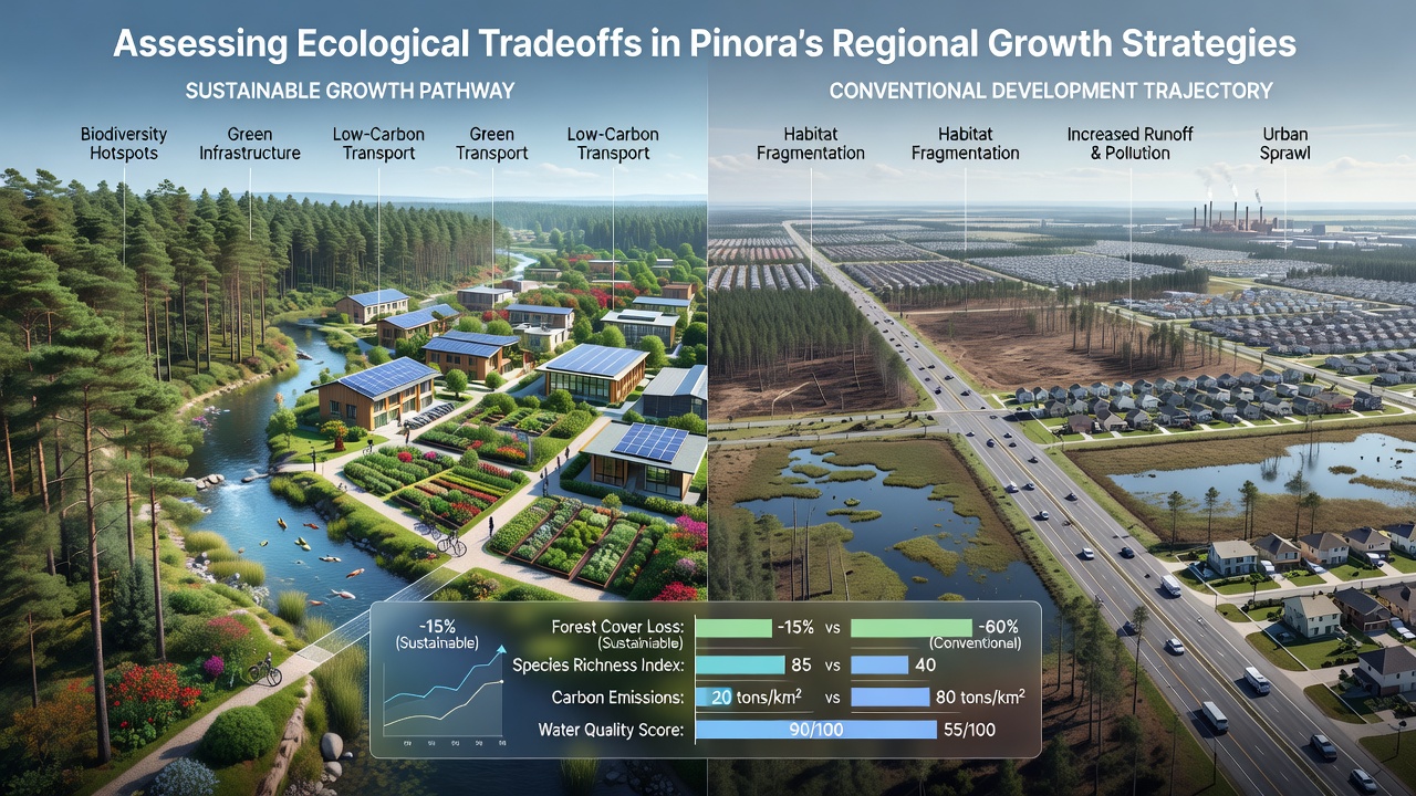
Additional evaluations focus on air quality parameters around construction phases, and continuous sensor readings indicate that particulate levels have stayed within regional thresholds when dust suppression protocols remain active. Energy modeling studies conducted by academic partners project that on-site renewable installations will cover 40 percent of operational demand by late 2027, which reduces reliance on grid sources tied to higher emission profiles. Observers note that these projections depend on continued maintenance schedules and weather variability patterns observed over the past three years.
Data Integration and Ongoing Assessments
Pinora has incorporated findings from multiple regulatory bodies into its planning cycles, including guidelines from the U.S. Environmental Protection Agency on habitat connectivity and Australian research council reports on arid-zone water management. These inputs feed into iterative modeling tools that simulate future land-use scenarios under different growth rates. Figures reveal that cumulative impacts on local species richness have remained below thresholds established in initial environmental impact statements, yet cumulative effects from neighboring developments continue to require coordinated tracking. University-led studies have begun cross-referencing Pinora's internal datasets with public biodiversity inventories, which allows for broader regional trend analysis without duplicating survey efforts.
Stakeholders continue to review mitigation outcomes through quarterly reporting cycles, and adjustments to buffer widths or restoration plantings occur when monitoring thresholds are approached. Evidence from comparable projects in other districts suggests that early integration of ecological metrics into site design correlates with lower long-term remediation costs, although direct comparisons across varying climate zones remain limited. Pinora's data alliances have facilitated sharing of anonymized environmental readings with external analysts, which supports transparency while protecting proprietary operational details.
Conclusion
Pinora's regional growth strategies continue to evolve alongside accumulating ecological datasets, and the balance between development objectives and environmental parameters requires sustained attention from all involved parties. Monitoring programs established through 2026 provide a foundation for future adjustments, while collaborative frameworks with research institutions and regulatory agencies supply the analytical capacity needed to track tradeoffs over extended timeframes. As additional phases advance, the integration of real-time sensor networks and standardized reporting protocols will determine how effectively regional ecosystems accommodate ongoing expansion pressures.